Visual
Images of any key defects
or email contact@roofinspectionglasgow.com
What is a drone roof survey? How it will save you money and provide total coverage.
Drone roof surveys offer significant advantages in speed, coverage, and cost-effectiveness compared to traditional methods. We differentiate a roof survey from a standard inspection by providing more comprehensive and systematic coverage. Roof surveys are typically conducted during property acquisition (acquisition surveys) or for larger properties, such as tenements (maintenance surveys), serving as the first step in developing a thorough maintenance and repair plan. A detailed roof survey report is also a valuable resource for property owners, providing essential documentation for insurers and roof repair contractors. This ensures transparency and clarity between clients and contractors when estimating and planning rectification work.
A roof survey can take place as part of a wider building survey. The surveyor may access the internal roof space to assess structural integrity, insulation and membrane material. At the very highest level a roof surveyor would assess a roof by hand using a cherry picker, ladder or scaffolding prising at different elements such as mortar, mastics, tiles and guttering. But this level of attention to detail is very unusual and is considerably more expensive.
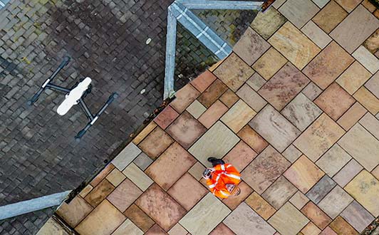
This is where conducting a roof survey using a drone provides considerable advantages. An old roof in bad condition could be dangerous to access with risk to the assessor and those below should anything be dislodged. Our survey process follows. Firstly an aerial photo of the entire roof area is taken, then methodically each of the following:
Each roof aspect is captured orthogonally for best coverage
Ridges, hips, valleys, parapets, including chimneys, bell towers
Dormers, roof windows and skylights and surrounding frames and flashing
Gutters, downpipes, vest pipes, vents, gullys
Rendering and masonry checked for gaps and cracks
antenna, satellites, solar panels,, HVAC, cabling
Our digital roof survey report based on our drone survey images will categorise the severity of any problems we find. As part of routine survey this aids proactive maintenance actioning any faults that will escalate in the coming months or years leading to damage. It allows accurate cost estimates to be made for repairs and transparency to the client what needs to be rectified. Something as simple as finding a slipped tile or blocked gutter could save a lot of money in further interior damage after heavy rain. It is at the discretion of the client how the data is assessed, either to self assess, have one of our professions or their own appointed chartered surveyor. Faults can be systematically covered and reported in terms of severity.
Images of any key defects
The location of the faults
Defects categorised by type
As either major, minor, monitor
List scored results
Our simplest option is to upload the images and report to the cloud and circulate an access link via email. However this doesn’t fully articulate the richness digital reporting can fully deliver. There are a number of online tools for data reporting drone data. For roof survey we recommend Scopito which allows surveyor and contractors access to the reporting. An example roof survey report can be downloaded here. All the images from the roof survey are reviewed, issues identified and listed. A bill of works with repair estimates is then prepared.
Residential property roofing tends to be small to medium but the layout can be more complicated on larger detached properties. Aside from direct damage problems can also arise for nesting birds, vegetation growth and blocked gutters. Our pricing is determined by the size of property, the type of building, access, location and proximity to no fly zones such as airports and stadiums. Generally under the 2020 drone regulation review we can fly a small drone most places.
Our operators can perform a drone roof survey of a small to medium property in around 30 minutes. For your piece of mind we are accredited by the CAA for safe use of drones via an Operational Authorisation. Our operations are also insured to £5 Million of public liability cover. On completion of the survey we can provide you with the images via an email link. It’s your choice if you require a full set of images or just the highlights. We can also provide a digital report or provide a full survey via one of our surveying partners both for an additional fee we will quote ahead of any work.
How It Works? Just fill out the contact form below with you name, email, phone number and requirements. Most importantly please provide your full address or link to a map pin. We require this information to plan a safe flight. We can still fly near airports but require additional time to gain authorisation. Ahead of the day please make any family members or neighbours aware a drone survey will be taking place. Some people are naturally wary given the bad press drones receive. On the day one of our operators will first meet you and go over any of your concerns.
Based on your supplied information and requirements
Convenient date and time arranged
We can’t fly in the rain and if very windy
Open side gates and inform neighbours
Images reviewed on site to check good coverage
These will be sent via an email link. Full reports if requested issued within 48 hours
Phone: (0141 280 9899)